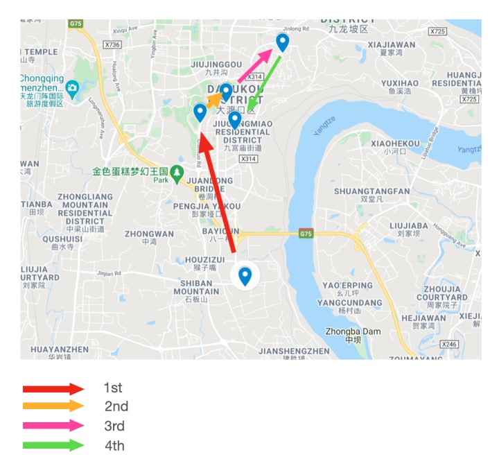
The driver will receive the calculated optimal route on his cell phone in a form of map, just as the figure 11 shows. Using Google map, I first notified all the community points as blue to form a map. Then, after getting the optimal route, I gained the order of the trashcans to be visited so I could use arrow with different color pointing from one site to another to inform the drivers.
